| More Information: |
| Hydraulic Analysis of St Joseph Bay |
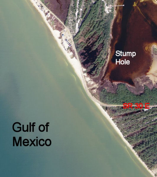
| St Joseph Bay is formed by a curving, rapidly eroding sand spit
with the prominent Cape San Blas located at its southern tip. A
narrow section of the peninsula at a site called Stump Hole will
likely breach in the near future. The new inlet will bisect the only
road available to peninsula residents and visitors to St Joseph
Peninsula State Park. Tidal hydraulic data were collected to
identify and quantify the hydrodynamic processes governing the Bay
system and to calibrate and verify a numerical hydrodynamic
circulation model (ADCIRC) for predicting the long-term fate of a
new inlet. Measurements showed that sub-tidal long wave energy
(associated with the passage of cold fronts) with periods near the
resonant seiche modes of the Bay was actually the dominant
hydrodynamic forcing that would control the inlet’s fate over short
time scales. Client: Florida Department of Transportation Reports: "Large Amplitude Seiche in St Joseph Bay, FL - Observation and Implications" "Observation and Implications of Long Waves in St Joseph Bay, FL" |
|
Aerial photo of threatened section of SR 30 E at location of likely breach at Stump Hole
|
|
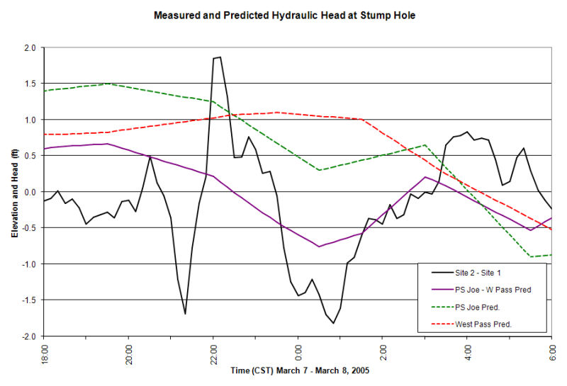
Plot showing measured (black) and predicted (purple) water elevation difference between St Joseph Bay and the Gulf
|
|
|
|
Reports: "Large Amplitude Seiche in St Joseph Bay, FL - Observation and Implications" "Observation and Implications of Long Waves in St Joseph Bay, FL" |
|
|